FreshRSS

🔒
❌ About FreshRSS
There are new articles available, click to refresh the page.
☐ ☆ ✇ SkeyDrone

Why financial institutions should include drone threats in their operational resilience strategy

By: Nele Coghe

Financial services are increasingly digital, but the infrastructure behind those services remains physical. Data centres, offices, network infrastructure and other critical facilities are essential to keeping financial services available. If these physical assets are disrupted, the consequences can quickly become digital: systems become unavailable, services are interrupted and customers can be affected.

This is where the Digital Operational Resilience Act (DORA) comes into play.

DORA is about more than cyberattacks

DORA requires financial entities in the EU to establish a comprehensive ICT risk management framework and protect the information and ICT assets that support their operations.
Importantly, this includes physical components and infrastructure such as premises, data centres and sensitive designated areas. DORA also requires financial entities to maintain the resilience, continuity and availability of ICT systems supporting critical or important functions.

The physical threat landscape is changing

Cyberattacks are an obvious threat to digital infrastructure. But financial institutions also face a broader range of physical and hybrid threats. Drones are one example.
Drones can be used to conduct reconnaissance, monitor sensitive facilities, interfere with operations or potentially support physical attacks. Even when no direct damage occurs, unauthorised drone activity around critical sites can be an early indicator of hostile or suspicious activity.

This is no longer purely a theoretical concern. Sweden’s financial supervisor, Finansinspektionen, explicitly identified drone fly-bys alongside cyberattacks, data breaches and cable disruptions as incidents that can challenge the operational resilience of financial-sector firms.

The blind spot above the building

Most financial institutions have invested heavily in perimeter security, access control, and camera coverage at ground level. Very few have visibility into the airspace above their sites.

That’s a gap. Drones can be flown for reconnaissance ahead of a physical intrusion, to disrupt operations at sensitive sites, or simply to fly where they shouldn’t over critical infrastructure. Most organizations have no way to detect, classify, or respond to that activity. For a data center or operations hub supporting a critical financial function, an unmanaged airspace is an unmanaged risk, and under DORA, unmanaged risk to a critical ICT asset is exactly what regulators are asking institutions to eliminate.

Where SiteSecure fits

SiteSecure, part of SkeyDrone’s suite of airspace solutions, was built for exactly this kind of site: critical infrastructure and sensitive locations that need continuous, reliable awareness of what’s happening above them.

Rather than raw drone detection alerts, SiteSecure applies the DITTA™ model to turn fragmented signals into a clear operational picture:

  • Detection: spot drone activity above the site in real time
  • Identification: determine drone type, operator and authorisation status
  • Tracking: follow position, movement, and behaviour over time
  • Threat Assessment: assess whether the activity represents a credible risk
  • Action: trigger an appropriate, proportionate response

For a financial institution, this means a documented, auditable process for monitoring physical airspace risk to critical sites. This is the kind of structured, evidence-based control that maps naturally onto DORA’s expectations around ICT risk management, protection and prevention, and the ability to demonstrate resilience to a supervisor.

Discover here how SiteSecure can help protect your critical sites.

The post Why financial institutions should include drone threats in their operational resilience strategy first appeared on SkeyDrone.
☐ ☆ ✇ SkeyDrone

Insights from Monitoring Drone Activity at Belgium’s Summer Events

By: Nele Coghe

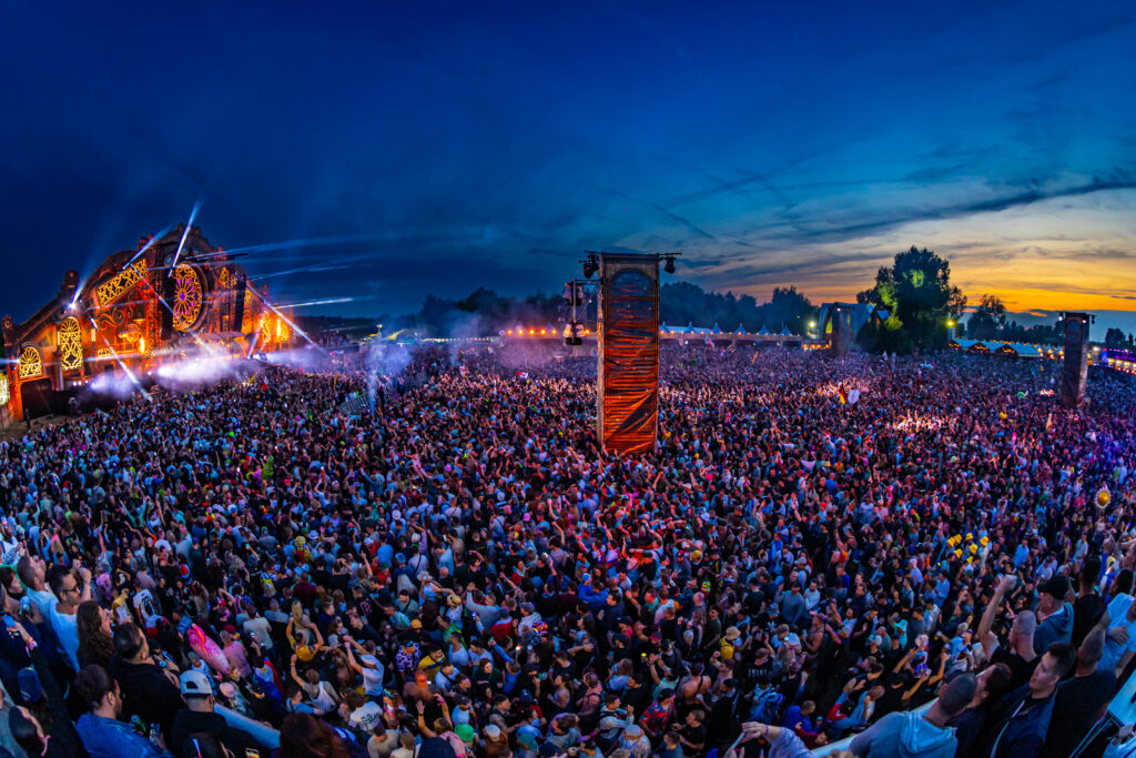
In July and August, SkeyDrone’s EventWatch solution monitored drone activity at several major outdoor events in Belgium, generating thousands of detection points and hundreds of flight tracks. The data reveals several trends that event organizers, security teams and public authorities should be aware of.

1. Drones Are Now Part of the Event Landscape

One observation stood out across all events: drones are no longer exceptional.
In total, we’ve detected 888 drone flights, originating from more than 100 different drones. This means that each drone conducted about 9 different flights on average, indicating that operators frequently fly multiple missions throughout the day rather than a single flight.
This leads us to conclude that large events are no longer occasional hosts of drone activity. They have become drone-rich environments where aerial operations must be expected and managed.

2. Not All Flights are Authorised

Many of the detected flights supported legitimate activities such as media production, event operations and security monitoring. However, unauthorised drones were also observed, highlighting a growing challenge for event organisers and security teams.
As drone adoption continues to increase, the question is no longer simply whether a drone is present. The real challenge is determining whether that drone is authorised to operate in that airspace at that time.
Effective airspace management therefore requires more than detection alone. It requires the ability to identify, track and assess drone activity in context, enabling security teams to quickly distinguish legitimate operations from potential risks.

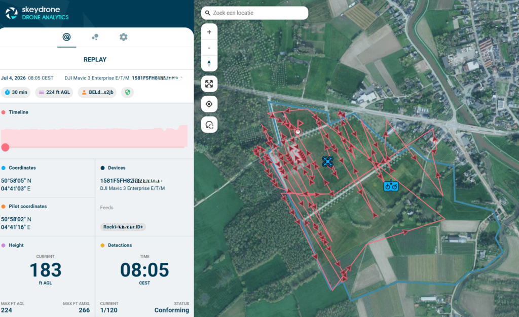
Example of a detected drone flight that was authorised and conforming to their submitted flight plan

3. Drone Activity Follows the Crowd

Across multiple events, drone operations displayed remarkably consistent patterns.
The highest levels of activity were typically observed during peak visitor hours, particularly between 6 PM and 9 PM, when events reached their highest attendance and operational intensity.
This predictability creates an opportunity. By understanding when drone activity is most likely to occur, organisers can allocate resources more effectively and maintain greater situational awareness during the moments that matter most.

4. Most Drones Fly at Operational Altitudes

Despite occasional high-altitude outliers, most flights remained within the 120-meter limit defined by the EASA open category.
This suggests that most drone flights are carried out for practical purposes rather than extreme-range or high-altitude missions. Common use cases include aerial filming, inspections, security support and operational coordination.

Looking Ahead

The data collected across Belgium’s summer events points to a clear conclusion: drones have become a permanent part of the event environment. As their use continues to grow, organisers need more than simple detection capabilities. They need the ability to distinguish authorised operations from potential risks, maintain situational awareness and make informed decisions in real time. As drones become a standard tool for media, security and event operations, situational awareness in the airspace above an event is rapidly becoming as important as situational awareness on the ground.

Learn more about our EventWatch solution here.

The post Insights from Monitoring Drone Activity at Belgium’s Summer Events first appeared on SkeyDrone.

☐ ☆ ✇ SkeyDrone

Clear Ownership, Better Collaboration: New Features in the SkeyDrone Hub

By: Nele Coghe

Effective drone monitoring is no longer just about detection. It is about coordination, accountability, and the ability to respond quickly and consistently when something happens. In the latest SkeyDrone Hub release, several new features have been introduced to strengthen exactly that: how teams collaborate, manage incidents, and maintain clear oversight.

Shaped by customer feedback, this update brings meaningful improvements across Drone Radar and Drone Analytics, alongside enhancements to the overall user experience. Together, they help organisations managing drone activity in a structured, auditable, and collaborative way.

Clear Ownership with Threat Assignment in Drone Radar

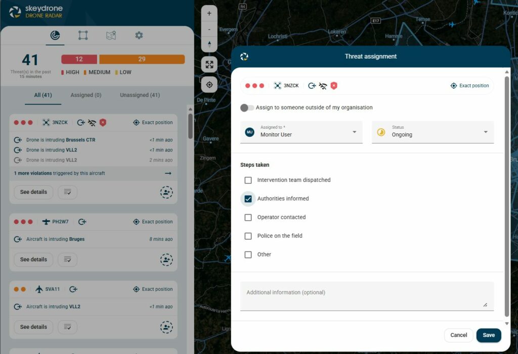
One of the most impactful additions is the ability to assign threats directly within Drone Radar.

When a potential threat is detected, it can now be assigned to a specific user within your organisation or to an external partner. This ensures that responsibility is immediately clear, eliminating ambiguity during time-critical situations.

Assignments are not static. Users can:

  • Define the actions that have already been taken, such as dispatching an intervention team, informing authorities, contacting the operator, or confirming police presence on site
  • Customise these steps to match internal procedures
  • Add notes to provide context and ensure a complete understanding of the situation

The assigned person receives a notification email, enabling fast follow-up. At the same time, assignments remain visible and editable, allowing teams to update progress or reassign responsibility if needed.

Importantly, all users have visibility of both assigned and unassigned threats. This shared overview ensures that everyone understands who is responsible for what at any given moment. The result is greater accountability, clear ownership, and significantly improved collaboration during incident handling.

From Detection to Follow-Up with Enhanced Reporting in Drone Analytics

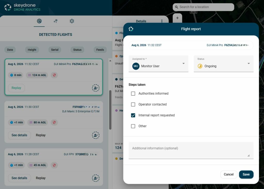
Managing an incident does not stop once the immediate threat is handled. Proper follow-up, documentation, and internal coordination are essential. The updated reporting functionality in Drone Analytics introduces a more structured approach to incident management. Reports can now be created directly from the Detected Flights menu. This automatically links the report to the selected flight, reducing manual work and ensuring that all relevant data is captured from the start.

Reports can be assigned to a specific person, with clear ownership of follow-up actions. Within each report, teams can:

  • Track the status of the report
  • Record which steps have already been taken, such as informing authorities, contacting the operator, or requesting internal reports
  • Define additional actions that still need to be completed

This creates a shared workflow where teams can collaborate within one single platform on post-incident handling, ensuring that nothing is overlooked and that every action is documented.


A More Intuitive Aircraft Details Page


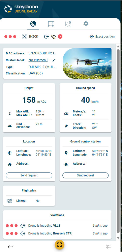
The Aircraft Details page in Drone Radar has been redesigned with a more modern look and feel.

Beyond visual improvements, the update enhances usability by making key information easier to access and interpret. Each aircraft, whether crewed or uncrewed, now includes an image, helping operators quickly identify what they are dealing with.

This improved user experience supports faster decision-making, especially in high-pressure situations where clarity is essential.

Greater Autonomy with the New Profile Page

User management has also been simplified with the introduction of a new self-service profile page. Users can now manage their own personal information without relying on administrator support. This includes updating their name,  phone number,  and changing their password. By giving users direct control over their profiles, organisations benefit from reduced administrative overhead and more accurate, up-to-date user information.

Strengthening Collaboration Across the Board

While each of these features delivers value individually, their real strength lies in how they work together. Threat assignment ensures that every incident has a clear owner. Enhanced reporting structures the follow-up process and keeps teams aligned. Improved interfaces make information easier to interpret, while self-service capabilities streamline user management. Combined, these updates transform the SkeyDrone Hub into a more collaborative, transparent, and efficient platform for drone monitoring and incident management.

For organisations responsible for critical infrastructure, where every second counts and every action must be traceable, these improvements provide a solid foundation for more effective and accountable operations.

Log in to the SkeyDrone Hub to see these new features in action.

The post Clear Ownership, Better Collaboration: New Features in the SkeyDrone Hub first appeared on SkeyDrone.
☐ ☆ ✇ SkeyDrone

SkeyDrone Kicks Off Festival Season

By: Nele Coghe

Brussels, 26 June 2026 — This weekend, SkeyDrone is kicking off the festival season with the first implementation of our EventWatch solution this summer.

In recent years, local police authorities typically took the lead in deploying temporary drone detection solutions to safeguard large-scale festivals. This year, that responsibility has shifted towards event organisers as part of their broader safety and security planning, carried out in close collaboration with local authorities.

This shift is driven by a more structured, risk-based approach. Organisers are required to conduct comprehensive risk assessments, including the potential impact of drones. When drone-related risks are assessed as limited, primarily involving regulatory breaches, the responsibility for monitoring the lower airspace lies with the organiser. In contrast, when more complex or higher-risk scenarios are identified, the police take the lead.

Even when organisers are responsible for monitoring drone activity, close coordination with authorities remains essential. Real-time data must be shared with the Gold Commander, as only the police have the legal authority to intervene when required.

This evolving model requires more than just detection, it demands actionable insight. That is why SkeyDrone’s EventWatch solution applies the DITTA™ methodology, transforming raw drone data into clear, prioritised and actionable intelligence for event teams and authorities.

SkeyDrone supports organisers in this new reality with a proven, operationally ready solution for drone monitoring at large-scale events. By combining advanced detection technologies with intelligent data processing, the platform delivers real-time visibility into drone activity in and around the festival area. It filters out irrelevant signals, prioritises potential threats, and translates complex data into clear, actionable insights for on-site teams.

“Festival organisers don’t need more data, they need clarity and confidence in their decision-making,” says Stijn De Vleeschhouwer, Managing Director at SkeyDrone. “Our platform is designed to turn fragmented drone signals into a real-time operational picture that both organisers and authorities can act on immediately.”

With extensive experience in securing complex environments, SkeyDrone is proud to support festival organisers this summer in delivering safe, compliant, and resilient events. Learn more about our EventWatch solution here.

About SkeyDrone

SkeyDrone helps airports, seaports, and critical infrastructure operators take full control of their airspace, while supporting safe, legitimate drone operations at the same time. In seconds, we turn raw sensor data into clear threat assessments. By combining drone detection, flight authorisation, and situational awareness in one platform suited for dual use, we show what is flying, what is approved, and what needs action. The result: fewer false alarms, fewer unnecessary shutdowns, and safe, uninterrupted operations where they matter.

The post SkeyDrone Kicks Off Festival Season first appeared on SkeyDrone.
☐ ☆ ✇ SkeyDrone

SkeyDrone Launches New Website Focused on Dedicated Airspace Solutions

By: Nele Coghe

Brussels, 24 June 2026 — SkeyDrone is proud to announce the launch of its newly redesigned website, reflecting a clear evolution in how we support organisations operating in increasingly complex lower airspace environments.

As part of this evolution, we are also introducing our new tagline: “Your eyes in the skies.” This replaces our previous positioning and better captures SkeyDrone’s role as a real-time intelligence layer, providing visibility, clarity, and actionable insight wherever drone activity matters most.

As drone activity continues to grow across industries, so does the need for tailored, operationally relevant solutions. Our updated website now centres around six dedicated verticals, each designed to address specific real-world challenges:

RunwaySafe

Purpose-built for airports and ANSPs, RunwaySafe enables safe and efficient drone incident management without disrupting operations. It transforms detection data into actionable insight, supporting faster and more informed decision-making in controlled airspace.

SiteSecure

Designed for critical infrastructure and sensitive sites, SiteSecure provides continuous drone monitoring and threat assessment. It enhances situational awareness and strengthens perimeter security against unauthorised drone activity, while supporting legitimate drone operations.

EventWatch

Developed for large-scale events and public gatherings such as festivals, EventWatch delivers real-time drone oversight to ensure safety in dynamic and crowded environments. It empowers security teams and local authorities with clear visibility and coordinated response capabilities.

PortGuard

Designed for ports and maritime environments, PortGuard offers real-time situational awareness. It helps port authorities to assess drone risk with clarity, while enabling legitimate drone operations to continue safely.

AirDefend

Focused on defence and high-security contexts, AirDefend is developed to support military and governmental stakeholders with enhanced drone situational awareness and threat evaluation capabilities in complex and contested airspace.

JustFly

Created for drone operators conducting BVLOS flights, JustFly supports safe and compliant operations by providing a clear and reliable real-time picture of surrounding air traffic. This enables tactical deconfliction when needed and enhances situational awareness throughout the flight.

Stijn De Vleeschhouwer, Managing Director at SkeyDrone comments: “This new structure reflects SkeyDrone’s commitment to moving beyond detection alone. By combining data from multiple sources into a unified intelligence layer, we provide actionable insights tailored to each operational context. The website update marks an important step in making our solutions clearer, more accessible, and aligned with the needs of our customers across aviation, infrastructure, public safety, and beyond.”

Discover the new SkeyDrone experience and explore how each solution supports safer, smarter skies, with SkeyDrone as your eyes in the skies.


About SkeyDrone

SkeyDrone helps airports, seaports, and critical infrastructure operators take full control of their airspace, while supporting safe, legitimate drone operations at the same time. In seconds, we turn raw sensor data into clear threat assessments. By combining drone detection, flight authorisation, and situational awareness in one platform suited for dual use, we show what is flying, what is approved, and what needs action. The result: fewer false alarms, fewer unnecessary shutdowns, and safe, uninterrupted operations where they matter.

The post SkeyDrone Launches New Website Focused on Dedicated Airspace Solutions first appeared on SkeyDrone.
☐ ☆ ✇ SkeyDrone

Belgium Expands C-UAS Use

By: Nele Coghe

On 12 June 2026, the Belgian Council of Ministers approved a draft law proposed by Minister Vanessa Matz aimed at regulating the use of antidrone jamming technology. The proposal addresses a fundamental gap in current legislation: while drone detection capabilities have advanced rapidly, the legal ability to intervene remains tightly restricted.

Traditionally, the use of signal‑jamming devices, which disrupt the communication between a drone and its operator, has been strictly prohibited under telecommunications law.
Until now, only police and defence (including NATO and SHAPE) were allowed to use such tools under exceptional circumstances. The new proposal changes that.

What Will Change?

1. Expanded Access to C‑UAS Mitigation Capabilities

The most significant shift is the extension of jamming rights beyond state security actors. Under the proposed law, operators of critical infrastructure would also be allowed to deploy anti‑drone technologies. This includes:

  • Nuclear facilities
  • Prisons
  • Seveso sites (industrial sites handling hazardous substances)
  • EU institutions and other sensitive locations

This is a major policy evolution: for the first time, non‑government operators responsible for critical infrastructure may gain the legal right to actively neutralise drone threats.

2. Strict Governance and Safeguards

The Belgian government is clearly aware of the risks associated with jamming technologies. The proposal therefore introduces a strict regulatory framework, including:

  • Mandatory authorisation from the Belgian telecom regulator (BIPT)
  • A casebycase risk assessment before each use
  • A mandatory reporting obligation within two hours of deployment

These safeguards are essential, because jammers can disrupt not only drones but also emergency communication systems, medical equipment and aviation navigation services. The goal is to strike a balance between security needs, and the integrity of critical communications infrastructure.

What This Means for Critical Infrastructure Protection

Perhaps the most important takeaway is the fact that drone threats are now officially recognised as a critical infrastructure risk. This aligns directly with broader regulatory trends such as NIS2 and CER (Critical Entities Resilience Directive).

In that context, this proposal strengthens the toolbox available to infrastructure operators and reinforces the expectation that they must actively manage drone risks.

Read here why drone detection is essential to comply with CER.


About SkeyDrone

SkeyDrone helps airports, seaports, and critical infrastructure operators take full control of their airspace, while supporting safe, legitimate drone operations at the same time. In seconds, we turn raw sensor data into clear threat assessments. By combining drone detection, flight authorisation, and situational awareness in one platform suited for dual use, we show what is flying, what is approved, and what needs action. The result: fewer false alarms, fewer unnecessary shutdowns, and safe, uninterrupted operations where they matter.

The post Belgium Expands C-UAS Use first appeared on SkeyDrone.
☐ ☆ ✇ SkeyDrone

Belgium Expands C-UAS Use

By: Nele Coghe

On 12 June 2026, the Belgian Council of Ministers approved a draft law proposed by Minister Vanessa Matz aimed at regulating the use of antidrone jamming technology. The proposal addresses a fundamental gap in current legislation: while drone detection capabilities have advanced rapidly, the legal ability to intervene remains tightly restricted.

Traditionally, the use of signal‑jamming devices, which disrupt the communication between a drone and its operator, has been strictly prohibited under telecommunications law.
Until now, only police and defence (including NATO and SHAPE) were allowed to use such tools under exceptional circumstances. The new proposal changes that.

What Will Change?

1. Expanded Access to C‑UAS Mitigation Capabilities

The most significant shift is the extension of jamming rights beyond state security actors. Under the proposed law, operators of critical infrastructure would also be allowed to deploy anti‑drone technologies. This includes:

  • Nuclear facilities
  • Prisons
  • Seveso sites (industrial sites handling hazardous substances)
  • EU institutions and other sensitive locations

This is a major policy evolution: for the first time, non‑government operators responsible for critical infrastructure may gain the legal right to actively neutralise drone threats.

2. Strict Governance and Safeguards

The Belgian government is clearly aware of the risks associated with jamming technologies. The proposal therefore introduces a strict regulatory framework, including:

  • Mandatory authorisation from the Belgian telecom regulator (BIPT)
  • A casebycase risk assessment before each use
  • A mandatory reporting obligation within two hours of deployment

These safeguards are essential, because jammers can disrupt not only drones but also emergency communication systems, medical equipment and aviation navigation services. The goal is to strike a balance between security needs, and the integrity of critical communications infrastructure.

What This Means for Critical Infrastructure Protection

Perhaps the most important takeaway is the fact that drone threats are now officially recognised as a critical infrastructure risk. This aligns directly with broader regulatory trends such as NIS2 and CER (Critical Entities Resilience Directive).

In that context, this proposal strengthens the toolbox available to infrastructure operators and reinforces the expectation that they must actively manage drone risks.

Read here why drone detection is essential to comply with CER.


SkeyDrone helps airports, seaports, and critical infrastructure operators take full control of their airspace, while supporting safe, legitimate drone operations at the same time. In seconds, we turn raw sensor data into clear threat assessments. By combining drone detection, flight authorisation, and situational awareness in one platform suited for dual use, we show what is flying, what is approved, and what needs action. The result: fewer false alarms, fewer unnecessary shutdowns, and safe, uninterrupted operations where they matter.

The post Belgium Expands C-UAS Use first appeared on SkeyDrone.
☐ ☆ ✇ SkeyDrone

SkeyDrone: An Independent Partner in a Collaborative Drone Ecosystem

By: Nele Coghe

At SkeyDrone, we believe that addressing complex drone challenges requires more than technology alone. It requires strong partnerships, an open ecosystem, and the ability to bring together the right capabilities for each unique context.

As an independent software provider, we are hardware-agnostic by design. This independence enables us to collaborate with a wide range of specialised partners, across hardware, services, and industry ecosystems, without being limited to a single vendor or solution. Sometimes customers have already selected their hardware, in which case it becomes a matter of seamlessly integrating it and enabling a plug-and-play connection with our platform.

We have built strong and trusted relationships with a number of key partners across the ecosystem, operating within a non-exclusive framework. This ensures that we remain fully objective and flexible in selecting the most appropriate solutions for each situation.

Our partnership-driven approach allows us to:

  • Integrate best-in-class hardware solutions from multiple providers
  • Collaborate with expert organisations delivering operational and advisory services
  • Engage with media and industry partners to contribute to broader awareness and knowledge-sharing

A recent example of this approach in action is our participation in the Belgian TIE, where we demonstrated how different drone detection technologies can be combined into a cohesive, layered system. You can read more about this here.

By working across a diverse international partner network, we ensure that each solution is tailored, future-proof, and aligned with real operational needs. This flexibility is essential in a rapidly evolving landscape where no single technology can address all challenges.

Our role is to connect the dots, bringing together the right partners, technologies, and expertise to deliver integrated, high-performance solutions.

We remain continuously open to new partnerships that strengthen our ecosystem and enhance the solutions we deliver to our customers. At SkeyDrone, partnership is not just part of how we work. It is at the core of what we do.

If you’re interested in becoming a SkeyDrone partner, don’t hesitate to drop us an email.

The post SkeyDrone: An Independent Partner in a Collaborative Drone Ecosystem first appeared on SkeyDrone.
☐ ☆ ✇ SkeyDrone

Insights from our RunwaySafe Webinar

By: Nele Coghe

SkeyDrone has launched RunwaySafe, an advanced drone threat assessment solution purpose‑built for airport environments. Developed in close collaboration with airport operations teams and air traffic control, RunwaySafe brings a new level of intelligence to drone incident management.

Unlike traditional drone detection systems that generate alerts for every drone entering controlled airspace, RunwaySafe assesses each event in real time and highlights only those drone flights that pose a genuine and immediate risk to airspace safety or airport security.

The result: fewer false alarms, clearer decision making, and faster recovery after drone incidents.

In this webinar we discussed:

  • EASA‑based 3D airport threat zone modelling
  • Dynamic runway configuration aligned with live airport operations
  • Configurable threat classification logic tailored to your concept of operations 
  • Seamless UTM integration
  • …and more practical insights from real‑world airport use cases

This webinar is a must-see for airport operators, ANSPs, and aviation security professionals looking for a robust solution to drone threat management.

X
Please enable JavaScript in your browser to complete this form.
Name
Loading

Q&A overview

The webinar recording doesn’t include the Q&A segment, but don’t worry! We’ve compiled the most pressing questions and expert answers below.

Q: An urgent drone operation from the police received authorisation via a call to the tower instead of via the UTM system. Will it appear as a threat in your system?

A: The software offers whitelisting capability. You can temporarily mute certain operations based on the drone’s serial number or the operator’s ID for a designated period. Additionally, it’s possible to assign a custom label to any drone that has been whitelisted.

Q: Which actions should the airport or air traffic control take when a drone threat has been identified by your system?

A: In addition to implementing technology, it is essential to establish appropriate procedures. How to respond to a drone threat should be described in detail in the rogue drone procedure. This procedure is part of a larger concept of operations (CONOPS). The CONOPS describes when a detection warrants monitoring, when it demands escalation, and when it should trigger a coordinated operational response. This provides structure and clarity for all stakeholders involved in managing drone-related risks.

RunwaySafe is engineered to complement relevant CONOPS by providing a configuration module for threat rule management. The system continuously calculates threat levels in real time according to your specified rules, supporting three distinct threat categories: High, Medium, Low, as well as an option for no threat. This enables seamless integration with CONOPS protocols and facilitates appropriate procedural responses when a drone is detected near the airport.

Q: How does the identification of the drones work?

A: From 1 January 2024, all drones in the EU operating in the specific category and some drones with class marks operating in the open category are required to operate with an active remote identification system (EASA, 2023). This allows for identifying drones remotely in the air and on the ground. Drones broadcasting this signal are called “cooperative drones” and typically do not pose significant threats, unlike non-cooperative drones.

Radio Frequency (RF) detection passively identifies and locates drones by intercepting the radio signals they emit, whether they cooperate or not. An advanced RF-based detection system does not only detect RF signals, but also decodes and decrypts the communication link between the drone and its operator based on info from a continuously updated drone database. By analysing these data packets, the system can extract detailed information such as GPS coordinates, height, speed, and even the drone’s model and its serial number.

Q: Does RunwaySafe rely on AI to predict flight paths and anticipate intrusions?

A: Our system has already recorded more than 100,000 drone flights in the vicinity of different airports and this number is increasing every day. This provides a rich dataset with unique behavioural insights to train AI models. Unfortunately for the algorithm, we haven’t detected enough malicious operations yet to predict malicious intent.

While AI is currently a top priority on the RunwaySafe roadmap, intelligence can already be added by applying advanced filtering to specific parameters. Parameters such as the drone type, speed, height, flight pattern, duration and timestamp can help assessing potential threats and differentiate between reckless and malicious operators.

We’d like to thank everyone who attended the webinar and contributed to the live Q&A. If you missed the session or want to revisit it, you can access the recording here.

The post Insights from our RunwaySafe Webinar first appeared on SkeyDrone.
☐ ☆ ✇ SkeyDrone

Employee in the Spotlight: Cedric Hoste

By: Nele Coghe

From Financial Services to Flight Paths

Some career moves are carefully calculated. Others simply click.

For our new Project Manager, Cedric Hoste, joining SkeyDrone was one of those rare moments where multiple forces aligned: industry momentum, personal affinity, and a desire to apply hard‑earned experience where it truly matters.

A sector with real momentum

“The drone industry is one of those sectors where you can genuinely feel the momentum,” Cedric explains. “Geopolitically, regulatorily, commercially… it’s a hot topic for real reasons.”

That sense of urgency was a major draw. Drone detection and airspace safety are no longer abstract future challenges; they’re happening now, with tangible implications for critical infrastructure, aviation, and public safety. Being close to those developments, and contributing meaningfully to them, was an important reason for Cedric to join SkeyDrone.

But there was more.

A personal connection to aviation

“I grew up near the airport,” Cedric says. “There’s an affinity there that’s hard to explain. It’s just wired in.”

When he discovered what SkeyDrone was building, technologies operating at the intersection of aviation, security, and innovation, something resonated. It wasn’t just intellectually interesting; it felt familiar on a deeper level.

And then came the professional challenge. After years in financial services, Cedric had built a strong foundation in disciplined thinking: frameworks, capital allocation, risk, growth. The question was where to take that expertise next.

“A high‑growth startup felt like exactly the right environment to stress‑test it,” he explains. “Not just apply it, but really stretch it.”

SkeyDrone brought all three elements together.

“That doesn’t happen often,” he says with a smile. “I had to surrender.”

A culture you feel, not read about

Ask Cedric what stands out most after joining, and the answer comes quickly.

“The people,” he says. “I know it sounds like a cliché, but it’s true. At SkeyDrone, the team is small but intentionally diverse: young talent alongside seasoned experts, introverts and extraverts, commercial and deeply technical profiles, all working literally in the same room. That physical proximity does something,” Cedric reflects. “There are no silos to hide behind. No teams operating in their own bubble. What makes it different is that openness isn’t a value written on a wall, it’s how the organization runs day to day. The connection built in that environment goes far beyond what any formal team‑building exercise could manufacture. It’s one of those things you only fully appreciate after working in a 2,000‑person organization,” he adds, “with twelve Slack channels and still no idea what the person three desks away is actually working on.”

Building not just products, but an organization

When it comes to impact, Cedric thinks on two levels.

Externally, the ambition is clear: help grow SkeyDrone into the European reference point for drone detection. Not just a strong player, but the standard others look to, by customers, partners, and the wider ecosystem.

Internally, the focus is on readiness.

“The technology moves incredibly fast,” he says. “New capabilities, new regulations, new threat vectors. In that environment, long‑term success isn’t just about having the best product today. It’s about building an organization that can scale, adapt, and consistently turn emerging technology into robust, best‑in‑class ways of working. That’s the kind of SkeyDrone I want to help build.”

Staying sharp by being present

Outside of work, staying sharp doesn’t mean doing more for Cedric, it means being intentional.

“I believe in presence,” he says. “Working hard and recharging aren’t opposites. They just happen in different modes.”

One ritual stands out: putting his son to bed. “For those fifteen minutes, the phone goes away. No notifications, no half‑thoughts about tomorrow. Just that moment. It may sound small, but those moments matter. They restore something essential.

Beyond that, it’s books and long walks with the dogs. No agenda. No output. Just the kind of slowness that makes speed sustainable. “Call it mindfulness if you need a label,” he says. “For me, it’s just how you make the fast work, long term.”

Welcome to the team

With a clear strategic mindset, a strong sense of purpose, and a grounded approach to leadership, our new Project Manager reinforces what SkeyDrone is building, not only in technology, but in culture.

And this is only the beginning.

Interested in more employee stories? Read the interview with Chloé here


The post Employee in the Spotlight: Cedric Hoste first appeared on SkeyDrone.
☐ ☆ ✇ SkeyDrone

Why Drone Detection Is Essential To Comply with the Critical Entities Resilience Directive

By: Nele Coghe

Across Europe, the security landscape for critical infrastructure is changing rapidly. Physical threats are becoming more complex, more frequent, and increasingly technology-driven. In response, the European Union introduced the Critical Entities Resilience (CER) Directive, a major regulatory framework designed to ensure that essential services remain operational, even during serious disruptions.

For operators of critical infrastructure, including airports, energy facilities, ports, government sites, and other essential service providers, this Directive introduces a clear obligation: resilience must be demonstrable, measurable, and continuously improved. And increasingly, resilience means addressing the growing risk posed by drones.

The CER Directive: A New Standard for Infrastructure Resilience

The CER Directive requires EU Member States to strengthen the protection of organisations that provide essential services to society and the economy, such as transport, energy, digital infrastructure, and public safety. By July 2026, countries must identify the entities that qualify as critical. Once designated, these organisations will have ten months to comply with the Directive’s resilience requirements, bringing the likely compliance deadline to May 2027.

Organisations identified as critical entities must then implement appropriate technical, security, and organisational measures to ensure continuity of their essential services.

Drones: A Growing Risk to Critical Infrastructure

Drones are transforming industries, enabling new services and efficiencies. But they also introduce a new category of risk for critical infrastructure. Unauthorised or malicious drone activity can lead to:

  • Operational disruptions
  • Safety incidents
  • Surveillance and intelligence gathering
  • Delivery of hazardous payloads
  • Cyberattacks

High-profile incidents at airports, energy facilities, and industrial sites have already demonstrated how a single drone can halt operations or trigger large-scale security responses. For organisations responsible for essential services, the inability to detect and assess drone activity represents a clear resilience gap.

Drone Detection as a Resilience Measure

Under the CER Directive, critical entities must adopt measures that are proportionate to the risks identified in their assessments. For many sectors, the ability to detect and understand drone activity in their airspace will become a fundamental part of their CER compliance strategy.

SkeyDrone’s SiteSecure solution can help critical infrastructure operators to:

  • Identify unauthorised drones approaching sensitive sites
  • Assess potential threats in real time
  • Coordinate with security teams and authorities
  • Maintain operational continuity during drone incidents
  • Document and analyse incidents

Our solution integrates seamlessly with different types of detection hardware and with existing security and operational systems, providing organisations with a clear, real-time view of drone activity in their vicinity.

For critical entities preparing for CER compliance, this capability plays an important role in addressing the Directive’s requirement for technical and security measures that ensure operational resilience.

Preparing for the 2027 Compliance Deadline

With Member States currently finalising national strategies and identifying critical entities, organisations should begin evaluating the risks that could disrupt their essential services.

By integrating drone detection into their resilience strategy, critical infrastructure operators can close an emerging security gap while strengthening their ability to maintain operations under all conditions.

Ready to secure your airspace and protect your operations? Discover our SiteSecure solution and learn how we can help you stay ahead of drone threats and ensure operational resilience.

The post Why Drone Detection Is Essential To Comply with the Critical Entities Resilience Directive first appeared on SkeyDrone.
☐ ☆ ✇ SkeyDrone

SkeyDrone Launches RunwaySafe: Intelligent Drone Threat Assessment for Airports

By: Nele Coghe

Brussels, 5 March 2026 – SkeyDrone today announces the launch of RunwaySafe, an advanced drone threat assessment solution, purpose-built for airport environments. Developed in close collaboration with airport operations teams and air traffic control, RunwaySafe enables airports to move from simple drone detection to intelligent, risk-based decision-making.

Airports worldwide are facing an increase in drone sightings. Even unverified reports can trigger runway closures, flight delays and costly diversions. Limited situational awareness often makes it difficult to determine when it is safe to resume operations, extending disruption and impacting passenger confidence.

RunwaySafe addresses this challenge by assessing each drone sighting in real time and highlighting only those flights that pose a genuine and immediate risk to airspace safety or airport security.

“Airports cannot afford to close operations every time a drone is detected in controlled airspace,” said Stijn De Vleeschhouwer, Managing Director at SkeyDrone. “RunwaySafe provides the operational intelligence needed for airports and ANSPs to distinguish between irrelevant drone activity and genuine threats, enabling faster, safer and more proportionate decisions.”

From Detection to Decision Support

Unlike traditional detection systems that generate alerts for every drone entering controlled airspace, RunwaySafe applies aviation-grade operational logic aligned with real-world procedures. The platform visualises drone activity within a dynamic airport environment, automatically adapting to active runway configurations and operational modes.

Key capabilities include:

  • 3D Airport Threat Zones aligned with runways, approach paths and critical operational areas
  • Dynamic Runway Configuration reflecting real-time airport operations
  • Advanced Threat Classification to reduce false alarms and unnecessary escalations
  • ATM and UTM Integration for unified awareness across crewed and uncrewed traffic
  • Multi-Sensor Integration combining RF, radar, camera and acoustic detection systems
  • Analytics and Forensics supporting post-incident analysis and compliance reporting

RunwaySafe has been developed in close collaboration with skeyes, one of Europe’s leading ANSPs, in one of the world’s most complex airspaces and is aligned with frameworks and guidance from EASA, ICAO, ACI and IATA. The solution is also fully compliant with the internationally recognised Detection, Identification, Tracking and Threat Assessment (DITTA™) methodology.

By transforming raw detection data into actionable operational insight, RunwaySafe helps airports minimise unnecessary closures, protect passengers and assets, and restore operations with confidence after drone incidents.

Register for our webinar to see RunwaySafe in action.

About SkeyDrone

SkeyDrone operates at the forefront of integrating drones safely into the airspace. We enable airports, air navigation service providers, seaports, and critical infrastructure operators to manage and protect their lower airspace with confidence. By combining cutting-edge technologies for drone detection, flight authorisation, and situational awareness, we help organisations turn complexity into control. Our mission is to make low-level airspace safer, smarter, and more connected; from flight authorisation to real-time drone detection, from operational oversight to intelligent decision-making.

The post SkeyDrone Launches RunwaySafe: Intelligent Drone Threat Assessment for Airports first appeared on SkeyDrone.
☐ ☆ ✇ SkeyDrone

A World-First in Airspace Interoperability: SkeyDrone and SafeSky one year later!

By: Nele Coghe

For all pilots, whether flying crewed or uncrewed aircraft, situational awareness is everything. Knowing who else is in the air, and where they are is not a “nice to have”; it is a prerequisite for safe operations.

One year ago, SkeyDrone and SafeSky announced a strategic partnership enabling bidirectional data exchange between both platforms. The collaboration marked an important step towards improving airspace awareness and safety, as the skies become increasingly shared between crewed and uncrewed aircraft.

One Integration, Two Outcomes: Safer Drone Flights and Stronger Site Protection

Through this integration, SkeyDrone’s Traffic Information Service has been enriched with real-time in-flight traffic data from the SafeSky platform, including helicopters, gliders, paramotors, paragliders, trikes, and other aircraft. This directly improves situational awareness for drone operators, particularly when conducting missions beyond visual line of sight (BVLOS) and especially in airspace where drones and crewed aircraft operate in close proximity.

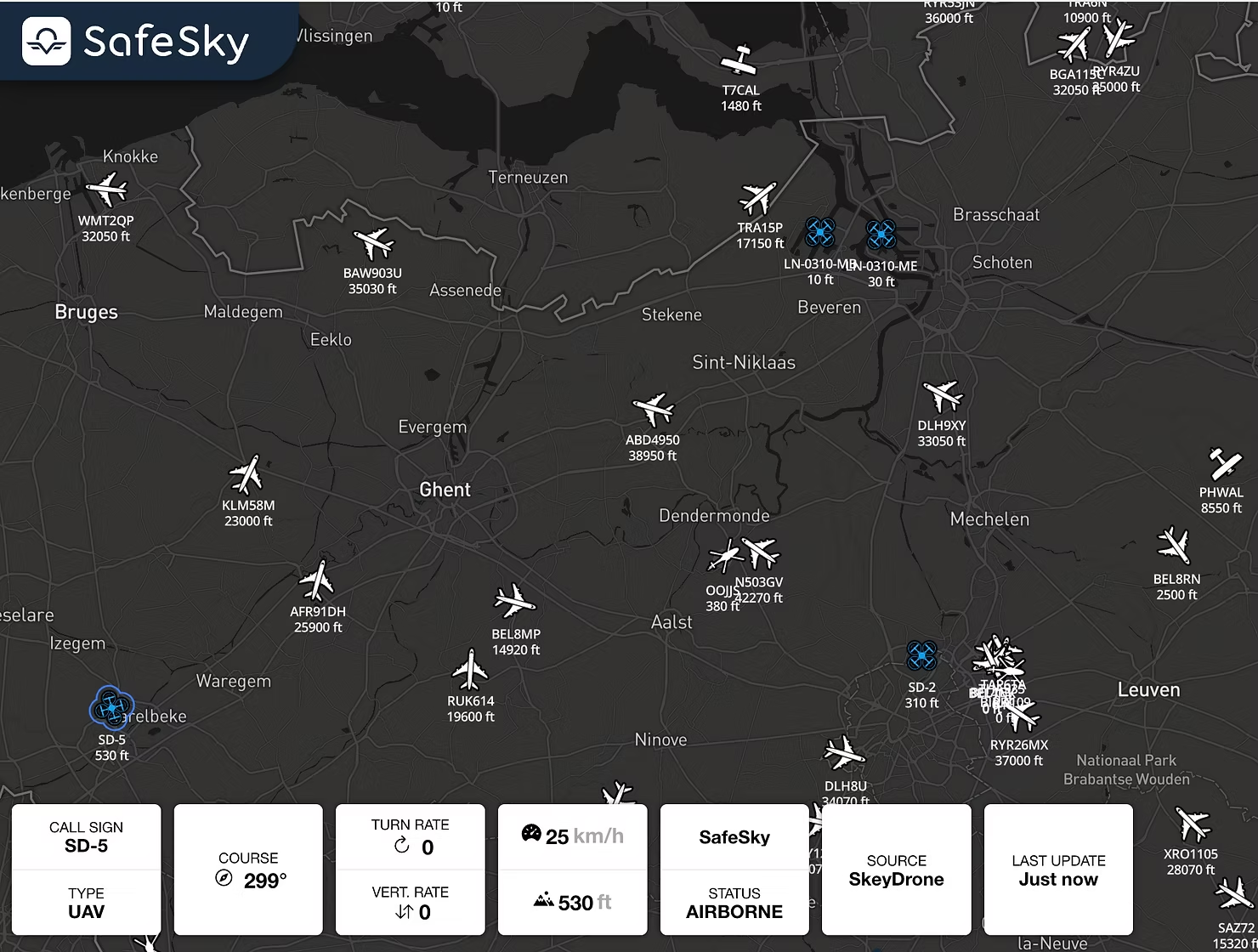
In parallel, through the SafeSky UAV API, SkeyDrone’s drone detection solution now also displays drone flights in locations that fall outside the reach of the existing sensor network, including operations across the Dutch and Luxembourg borders. Over the past year alone, this integration has resulted in more than 3,250 additional drone flights being displayed in the SkeyDrone platform, flights that would otherwise have remained unseen.

This expanded coverage is advantageous not only for drone operators flying BVLOS, but also for geozone and security managers utilising SkeyDrone to safeguard their sites from unauthorised drone activity. The SafeSky integration marks significant progress toward achieving comprehensive nationwide drone detection capability in Belgium.

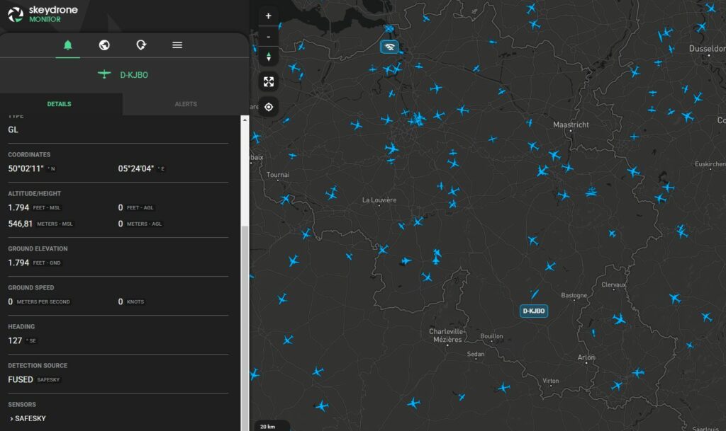
SkeyDrone’s Traffic Information Service enriched with data from SafeSky

Kristof Gilleman

Head of Operations at SkeyDrone

Through this partnership, we support BVLOS drone operators dependent on our Traffic Information Service, while also empowering geozone and security managers who use SkeyDrone to protect critical sites from unauthorised drone activity. The integration with SafeSky represents a major step towards a complete, nationwide aerial picture in Belgium.

Closing an Important Gap: What’s in It for Pilots?

Traditional aviation surveillance systems, such as ADS-B, Mode S, FLARM, were never designed with widespread drone integration in mind. While many professional drone operations today are fully authorised and compliant, yet from a cockpit perspective they may remain non-cooperative. They do not broadcast their position via standard aviation protocols, making them invisible to conventional traffic awareness tools. For VFR pilots operating below controlled airspace, where helicopters, training aircraft, gliders, microlights, and drones increasingly share the same airspace volume, this creates uncertainty. And uncertainty, in aviation, is always a risk factor.

By integrating drone detection outputs from SkeyDrone with the SafeSky APIs, SafeSky can provide live telemetry-based awareness of certain drone operations that would otherwise not appear on traditional aviation displays. And this is not about replacing “see and avoid”; it is about enhancing awareness in an environment where visual acquisition alone is no longer sufficient.

Tristan Fily

CEO at SafeSky

The future of aviation depends on crewed and uncrewed aircraft sharing the sky safely. This partnership with SkeyDrone demonstrates how interoperability can turn that vision into practical awareness for everyday pilots.

SafeSky displaying drones traffic from SkeyDrone integration

Looking Ahead — A Shared Vision for Connected Airspace

Airspace is evolving. The lower altitudes are becoming more dynamic, more diverse, and more operationally demanding. What used to be a largely homogeneous traffic environment is now a mixed ecosystem of recreational pilots, professional drone operators, emergency services, aerial work missions, and new mobility concepts. In this context, safety increasingly depends on interoperability.

The first year of operational data exchange between SkeyDrone and SafeSky demonstrates that bidirectional interoperability is not only technically feasible: it is operationally valuable. It enables visibility where it was previously limited. It reduces uncertainty where blind spots existed. And it lays the groundwork for a more unified airspace picture.

Belgium may be geographically small, but collaborations like this show how local innovation can have international relevance. By connecting ecosystems rather than competing in isolation, SkeyDrone and SafeSky are contributing to a broader shift in aviation: from fragmented visibility to shared awareness.

Both companies remain committed to expanding this cooperation, embracing cooperative and non-cooperative drone visibility, strengthening interoperability, and working with partners across the aviation and UAS community.

Learn more about SkeyDrone’s Traffic Information Service here.

The post A World-First in Airspace Interoperability: SkeyDrone and SafeSky one year later! first appeared on SkeyDrone.
☐ ☆ ✇ SkeyDrone

SkeyDrone and Unifly Deploy Major UTM Platform Upgrade at the Port of Antwerp-Bruges, Enhancing Safety and User Experience

By: Nele Coghe

Steenokkerzeel/Antwerp, 22 January 2026 – SkeyDrone and Unifly have released a major upgrade of their UAS Traffic Management (UTM) platform deployed at the Port of Antwerp-Bruges (PoAB). This new release strengthens operational safety and enhances user experience, further enabling one of the world’s most advanced port-based drone ecosystems.

Building on the strong innovation partnership between SkeyDrone, Unifly, and the Port of Antwerp-Bruges, the upgraded platform enhances capabilities for drone operators, supervisors, and port authorities. It continues the Port’s evolution from pioneering BVLOS trials under the SAFIR project to enabling thousands of drone operations, autonomous sample transport, and scalable industrial drone applications across one of the most drone-progressive ports globally.

PoAB DronePortal

Operational in the Antwerp port area since mid-March 2021, the PoAB DronePortal has enabled safe and compliant drone operations at scale.

Port of Antwerp-Bruges’ drone ecosystem at a glance:

  • 250 registered operators
  • 13,483 operations created
  • 7,665 operations performed
  • 27,621 permission requests approved
  • 2,371 BVLOS operations performed

Overview of the New Capabilities

The update introduces a broad set of new capabilities that enhance safety, useability, and efficiency across the Port of Antwerp-Bruges’ drone ecosystem. Improved airspace information, supported by updated obstacle data, increases situational awareness to support safer drone operations in one of Europe’s busiest and most complex port environments.

A series of user interface and data-management upgrades make the platform more intuitive and reliable, including clearer geozone visualisation, refreshed map layers, more helpful on-screen guidance, simplified explanations of flight rules, updated translations, and cleaner portal visuals. Users also benefit from a rebranded and expanded online help environment offering clearer, always-available guidance, as well as the introduction of Dark Mode for improved usability in a wide range of operational and lighting conditions.

A Platform Ready for the Next Stage of Port-Based Drone Innovation

This release marks another milestone in the Port of Antwerp-Bruges’ digital transformation of its airspace. By enhancing safety, improving situational awareness, and streamlining the operator experience, the UTM platform continues to support innovative drone applications, from industrial inspections to automated logistics, reinforcing PoAB’s position as one of the world’s most advanced ports for operational drone deployment.

To underline Unifly’s long-term commitment to enabling scalable and secure drone operations, Andres Van Swalm, CEO of Unifly, highlighted the significance of the upgrade: “With every release, we help the Port of Antwerp-Bruges unlock new operational efficiencies and safety standards. This upgrade prepares the Port for an increasingly automated future where drones integrate seamlessly into daily operations.”

Stijn De Vleeschhouwer, Managing Director of SkeyDrone, emphasised the value of these improvements for daily users and operational partners across the port: “With this new UTM upgrade, we are raising the bar once again. Users will benefit from a more reliable, intuitive, and efficient system that supports safe and consistent drone operations throughout the port.”

Reflecting on the Port’s ambitions, Didier Venneman, Coordinator Drone Operations at PoAB, emphasises the strategic importance of a future-ready UTM platform in supporting the growth of drone operations: “This upgrade reinforces our leadership in port-based drone innovation. By developing a more user-friendly application, the enhanced platform enables drone operators to plan and monitor missions more intuitively, improving safety and security across the port. It encourages new operators to adopt the system, ensuring compliance with regulations and increasing awareness of potential risks in a complex port environment.”


About SkeyDrone

SkeyDrone is a joint venture between the Belgian Air Navigation Service Provider skeyes and Brussels Airport Company. The company’s mission is to provide end-to-end solutions for all your business needs related to the use of uncrewed aircraft (drones). SkeyDrone offers solutions for lower airspace monitoring, management and protection against drones for authorities and geo-zone managers, UTM/U-space & consultancy services for drone operators and business integration services for companies. 

About Unifly

Unifly is a technology company rooted in aviation, dedicated to enabling autonomous aviation by advancing the safety and efficiency of UAS Traffic Management. The Unifly platform connects authorities, drone operators, and stakeholders to digitise and automate airspace management, supporting the safe integration of next-generation aircraft. With the addition of Unifly Consulting, the group combines cutting-edge digital infrastructure with deep regulatory and safety expertise. Offering SORA analyses, regulatory guidance, and operational strategy, Unifly provides a comprehensive ecosystem powering the future of autonomous aviation worldwide.

About Port of Antwerp-Bruges

As Europe’s second-largest seaport, the Port of Antwerp-Bruges is a global hub for trade, industry, and innovation. Through pioneering drone programs and close collaboration with partners such as Unifly and SkeyDrone, the Port is setting new standards for safe and scalable unmanned aviation. 

The post SkeyDrone and Unifly Deploy Major UTM Platform Upgrade at the Port of Antwerp-Bruges, Enhancing Safety and User Experience first appeared on SkeyDrone.
☐ ☆ ✇ SkeyDrone

SkeyDrone Partners with Amab for Assembly of SkeyBoxes

By: Nele Coghe

Steenokkerzeel, 15 December 2025 – SkeyDrone is proud to announce a new partnership with Amab, a leading Belgian social enterprise for customised work, to assemble SkeyBoxes, SkeyDrone’s signature hardware component used across its drone detection deployments.

As demand for SkeyDrone’s solutions continues to grow in Belgium and internationally, the company is expanding its production capacity while reinforcing its commitment to local, inclusive and high-quality manufacturing. Amab, known for its strong track record in precision assembly and its mission to create meaningful employment opportunities, offers a reliable and scalable production environment fully aligned with SkeyDrone’s operational standards.

The collaboration ensures that each unit is assembled with precision and care, while contributing to meaningful employment opportunities for people with disabilities. This clearly reflects SkeyDrone’s key values: innovation, partnerships, care and excellence.

Stijn De Vleeschhouwer, Managing Director of SkeyDrone, commented: “We are delighted to partner with Amab. Their expertise, flexibility and commitment to quality make them an excellent fit for supporting the growth of our operations. This collaboration not only enhances our production capabilities but also reflects our ambition to build a more sustainable and socially conscious value chain.”

Joëlle van der Veeken, Business Development Manager Elektro-Montage of Amab, added:
“We are proud that SkeyDrone has chosen Amab as an assembly partner. Our teams are motivated to contribute to innovative technologies that enhance safety in the airspace. This partnership highlights how social enterprises can play an important role in high-tech industries.”

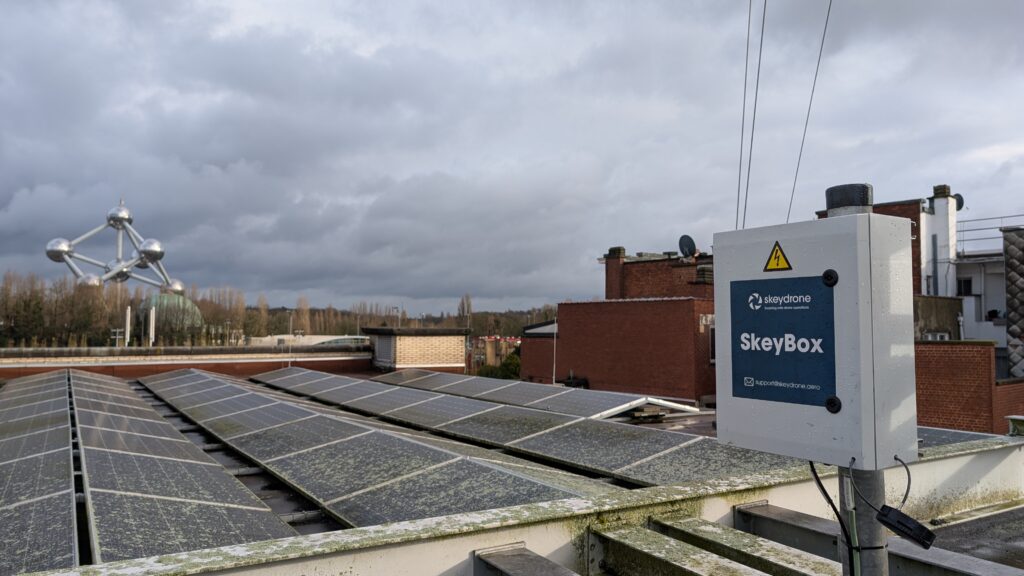
The first batch of Amab-assembled SkeyBoxes has already been delivered and deployed, with additional production planned in the coming months as SkeyDrone continues to strengthen its footprint in the drone detection domain.

About SkeyDrone

SkeyDrone is a joint venture between the Belgian Air Navigation Service Provider skeyes and Brussels Airport Company. The company’s mission is to provide end-to-end solutions for all your business needs related to the use of uncrewed aircraft (drones). SkeyDrone offers solutions for lower airspace monitoring, management and protection against drones for authorities and geo-zone managers, UTM/U-space & consultancy services for drone operators and business integration services for companies. Playing a pivotal role in the implementation of U-space in Belgium, SkeyDrone is on track to make history by becoming one of the first U-space service providers in Europe.

About Amab

Amab is a modern and reliable social enterprise for customised work (in the past referred to as a sheltered workshop), which has 800 employees in three easy-to-reach locations around Brussels, namely Asse, Beersel and Zaventem. Amab is aiming for a People, Profit and Planet environment that inspires people to personal growth who are not able to work in a normal work environment.

The post SkeyDrone Partners with Amab for Assembly of SkeyBoxes first appeared on SkeyDrone.
☐ ☆ ✇ SkeyDrone

Celebrating 5 Years at SkeyDrone: Spotlight on Tom Snyers

By: Nele Coghe

This month, we’re celebrating an important milestone at SkeyDrone: our Senior Product Manager, Tom Snyers, marks his 5-year anniversary with the company.

Tom joined SkeyDrone after several years in the innovation team at skeyes, Belgium’s air navigation service provider. For him, the move felt like a natural next step: “At skeyes, I was exploring innovative ideas, but at SkeyDrone I had the opportunity to actually build them and bring them to market. It was the chance to help shape a new industry from the ground up.”

That sense of momentum was clear from day one. Tom recalls walking into his first meeting; the kick off with an external development team to build the UTM platform. “From that moment, everything became very real. We weren’t just talking about possibilities anymore, we were creating them.”

Over the past five years, Tom has helped building solutions that push the boundaries of drone integration. One highlight was his presentation at Airspace World 2025 in Lisbon, where he introduced SkeyDrone’s concept of adding dynamic airport threat zones to the Drone Radar solution. It was the first time the idea was shared publicly, and the positive reactions confirmed it met a clear need in the industry. “That was a relief,” Tom admits. “It showed us we were on the right track.”

Tom presenting the concept of dynamic airport threat zones at Airspaice World 2025 in Lisbon

But beyond the projects and milestones, what stands out most for Tom is the team. Working in a start-up has taught him the value of collaboration and trust: “Having colleagues who are open-minded, confident, and aligned on purpose makes all the difference. Open communication—with each other, with customers, with partners—is essential.”

Of course, not all memories are tied to product launches or presentations. Tom often tries to step out of his comfort zone during team events to make his co-workers smile, whether by performing at karaoke nights, or dressing up as Santa for the office Christmas party.

Asked what advice he would give to newcomers at SkeyDrone, Tom doesn’t hesitate: “Don’t deliver half work but always aim for quality. And be open to feedback and different opinions. It’s through collaboration and listening to others that you really grow.”

As we celebrate this 5-year milestone, we want to thank Tom for his dedication, his vision, and his contribution to shaping SkeyDrone into what it is today. Here’s to the next chapter in this exciting journey!

Interested in more employee stories? Read the interview with Chloé here

The post Celebrating 5 Years at SkeyDrone: Spotlight on Tom Snyers first appeared on SkeyDrone.

☐ ☆ ✇ SkeyDrone

SkeyDrone and DronePort Sint-Truiden Launch National Counter Drone Testing and Expertise Centre

By: Nele Coghe

Steenokkerzeel/Sint-Truiden, 26 August 2025  – SkeyDrone and DronePort Sint-Truiden are proud to announce a strategic partnership to establish Belgium’s first permanent Drone Detection & Counter-UAS (C-UAS) Testing and Expertise Centre. This national hub will enable manufacturers of detection and C-UAS systems to test, validate and demonstrate their solutions, and integrate them into a comprehensive, multi-layered C-UAS system designed for both defence and civil authority use.

With drones becoming increasingly present in society, both for legitimate and malicious purposes, the demand for robust, interoperable C-UAS solutions has never been greater. In Belgium and across Europe, government agencies, critical infrastructure operators, and defence forces are seeking integrated detection and mitigation capabilities that are tested, validated, and proven in operational settings. Meeting this demand calls for state-of-the-art infrastructure combined with advanced system integration expertise, precisely what this new centre will deliver.

Complementary Strengths, Shared Vision

  • DronePort Sint-Truiden will provide the physical infrastructure and secure, real-world operational environment necessary for continuous testing, demonstrations, and stakeholder collaboration, opening its facilities to a wide range of parties developing both C-UAS systems and advanced drone technologies, and creating an environment where opposing technologies can challenge each other to enhance and future-proof airspace security.
  • SkeyDrone, as operator of Belgium’s national backbone drone detection network and U-space service provider, will enable the technical integration of the various subsystems, manage the interfaces with civil aviation stakeholders, safeguard compliance with regulatory frameworks, and connect participating solutions to its existing detection network.  

National Operational Backbone

Looking ahead, SkeyDrone envisages to operate its national base detection network and services from DronePort Sint-Truiden. This network already serves critical infrastructure across Belgium, including airports, strategic energy production and distribution sites, prisons, and offshore wind farms, as well as several local police zones. From DronePort Sint-Truiden, SkeyDrone plans to deliver real-time monitoring and alerting services nationwide.

Strategic Impact

This partnership will:

  • Establish Belgium’s national testbed for C-UAS innovation, accelerating time-to-market for Belgian and European technology providers.
  • Strengthen Belgium’s technological sovereignty in C-UAS capabilities.
  • Offer defence and civil authorities a trusted platform for evaluating and selecting integrated solutions.
  • Position Belgium as a European reference centre for drone detection and non-kinetic counter-drone technologies.

Ward Decaluwé, CEO of DronePort Sint-Truiden, commented: “With this C-UAS Centre, DronePort Sint-Truiden further establishes itself as the beating heart of Belgium’s drone ecosystem. By combining our unique infrastructure with SkeyDrone’s expertise, we are creating an innovation hub where authorities, technology providers, and end users can collaborate to address one of today’s most pressing airspace security challenges.”

Hendrik-Jan Van Der Gucht, Managing Director of SkeyDrone, added: “The establishment of this centre marks a pivotal step in building a safer and more resilient airspace. By leveraging DronePort’s operational environment and integrating it with our national detection backbone, we’re not only enhancing our service capabilities but also fostering a collaborative environment where industry, government, and defence can co-create the future of airspace security.

About SkeyDrone

SkeyDrone is a joint venture between the Belgian Air Navigation Service Provider skeyes and Brussels Airport Company. The company’s mission is to provide end-to-end solutions for all your business needs related to the use of uncrewed aircraft (drones). SkeyDrone offers solutions for lower airspace monitoring, management and protection against drones for authorities and geozone managers, UTM/U-space & consultancy services for drone operators and business integration services for companies. Playing a pivotal role in the implementation of U-space in Belgium, SkeyDrone is on track to make history by becoming one of the first certified U-space service providers in Europe.

About DronePort Sint-Truiden

DronePort Sint-Truiden is a unique 30ha industry park for innovative aviation companies, offering an ecosystem of innovative businesses and testing grounds within the aerospace and drone sector. DronePort Sint-Truiden offers state-of-the-art test facilities with segregated airspace, allowing you to test and demonstrate new applications to customers and train uncrewed aircraft system (UAS) pilots. All test grounds are managed by Limburg Regional Airport in close collaboration with the Belgian Civil Aviation Authority (BCAA), ensuring safe operations. Additionally, there are specialized testing grounds tailored to specific drone applications, such as for agriculture applications and BVLOS flights.

The post SkeyDrone and DronePort Sint-Truiden Launch National Counter Drone Testing and Expertise Centre first appeared on SkeyDrone.

☐ ☆ ✇ SkeyDrone

Employee in the Spotlight: Jan Keymis

By: Nele Coghe

From Criminology to Aviation: A Passion Turned Profession

Meet Jan Keymis, SkeyDrone’s dedicated project manager who joined the team two years ago. With a decade of professional experience under his belt, Jan decided it was time to pursue his passion for aviation—sparked during his many travels. A friend working at Brussels Airport pointed him towards a vacancy at SkeyDrone—and the rest is history.

Jan’s interest in drones started back in 2016 while travelling. Eager to capture high-quality footage of his adventures, he became an early adopter of the DJI Mavic—one of the first easily transportable drones on the market. That early curiosity laid the foundation for a deeper interest that would eventually guide his career.

Upon joining SkeyDrone, Jan was immediately thrown into the deep end: leading a pioneering drone use case project at Brussels Airport. The project involved using AI models to analyse drone footage—new territory at the time for everyone involved. Jan successfully managed the entire project from start to finish and takes great pride in the innovative results the team achieved.

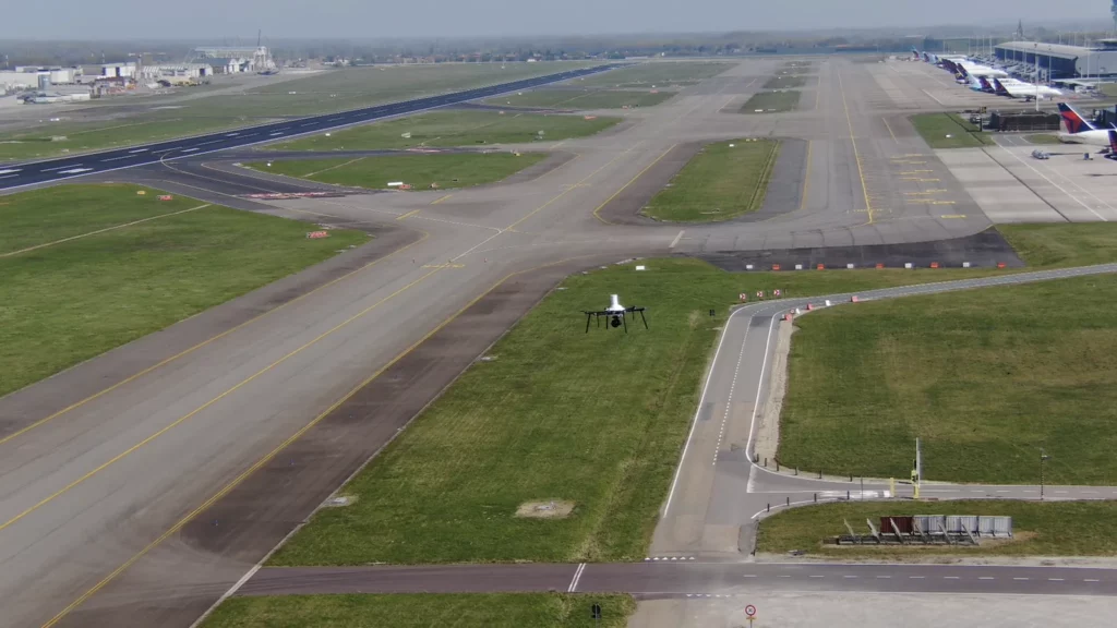
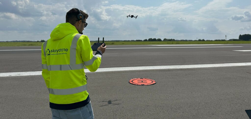
Jan flying his drone over a closed runway at Brussels Airport

Making a Societal Impact

Jan is particularly proud that his work contributes to something bigger than himself. “It’s important to me that my work has a societal impact,” he explains. “I’m proud to help shape the future of drone technology and its safe integration into everyday life.”

Jan holds a master’s degree in criminology, which surprisingly comes in handy more often than one might expect. For example, while preparing a drone surveillance mission, his knowledge of camera legislation proved instrumental in ensuring legal compliance.

Climbing High

Outside of work, Jan is an avid traveller and adrenaline enthusiast. He enjoys extreme sports such as climbing, diving and canyoning. His climbing skills are regularly put to good use during the installation of SkeyDrone’s drone detection antennas. Over the past two years, he has scaled some of Belgian’s highest buildings as part of his role.

Thanks to his hands-on experience with construction work at his own home, co-engineering and building the SkeyBoxes—which ensure reliable connectivity for the detection antennas—was a natural extension of his skills. Whether it’s climbing buildings or fine-tuning technical setups, Jan brings both precision and passion to every task.

With summer on the horizon, Jan is excited to once again lead antenna installations at high-profile events like Tomorrowland, Spa-Francorchamps and Lokerse Feesten.

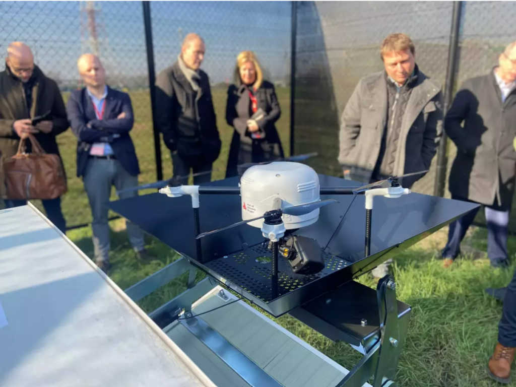
Jan installing a drone detection antenna

Elevating Operations

Another aspect of his job he truly enjoys is operating drone missions on behalf of SkeyDrone. A recent highlight includes supporting Belgium’s first BVLOS drone flight in active airspace—a significant milestone for the industry.

When asked what he enjoys most about his job, Jan says: “It’s the variety. No two days are the same.”

Looking ahead, he hopes to see the regulatory framework for drones evolve quickly so the industry can realise its full potential. And if the past two years are anything to go by, Jan will continue to be at the forefront of making that future a reality!

Interested in more employee stories? Read the interview with Chloé here

The post Employee in the Spotlight: Jan Keymis first appeared on SkeyDrone.

☐ ☆ ✇ SkeyDrone

6 New Features That Put You in Full Control of Your Airspace

By: Nele Coghe

At SkeyDrone, we are committed to helping our users gain better control, clarity, and confidence in the airspace they manage. Our latest release brings a powerful set of enhancements to Drone Radar and Drone Analytics, designed to streamline monitoring and give users more flexibility in how they interact with the platform.

Here’s a closer look at the new features now available:

1. Advanced monitoring preferences for control zones and flight plans

Customisation is key when managing complex operations, and our new individual monitoring preferences give Drone Radar users exactly that. You can now tailor your monitoring and alert settings per zone or flight plan—without affecting your organisation’s default configuration.
Whether you want to receive alerts for intrusions, conformance issues, or other specific events, you’re in full control. This means you’ll never miss what matters most to you, while your team members can stay focused on their own priorities.
You can configure default preferences that will be automatically applied to any newly created zone or flight plan. This eliminates the need for repetitive manual configuration, saving time and ensuring consistency across all zones.
Control zones will still be created and managed at the organisational level to maintain consistency.

2. Visualise control zones in Drone Analytics

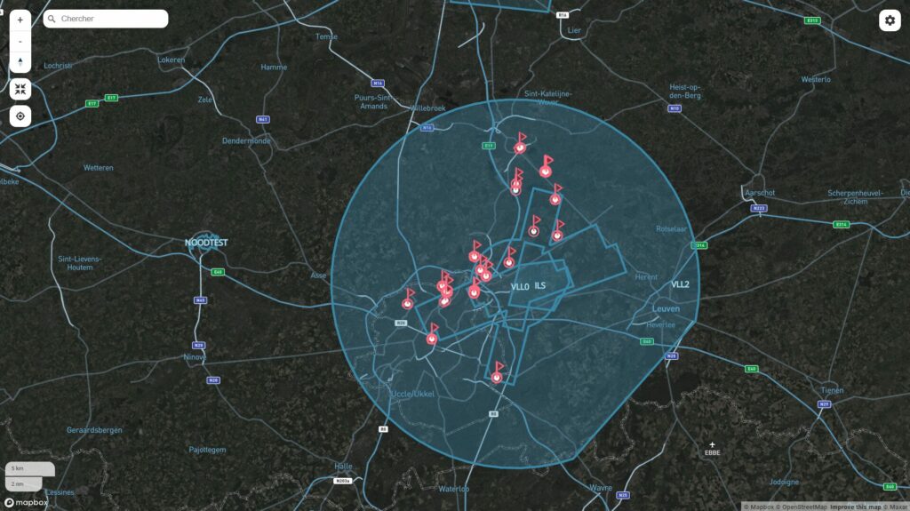
You asked, we delivered. Drone Analytics now offers a clear visual display of control zones and Areas of Responsibility (AoRs) directly on the map.
With just a click in the map settings, you can show or hide these zones based on your operational needs. This new feature provides the visual clarity needed to stay in control.

Figure 1: Visualise your control zones and areas of responsabilities on the map in Drone Analytics

3. Map zoom level preserved when filtering

Drone Analytics users can now adjust filters without losing their current zoom level. This small but powerful improvement ensures the map stays focused on the area that matters most—making it easier to maintain context as you refine your view.

4. New Twilight map view as default

Introducing the Twilight Street-Satellite Map (see figure 1), now the default map style in both Drone Radar and Drone Analytics. This hybrid view combines detailed street maps with high-resolution satellite imagery to help you quickly identify key landmarks. The darker tones increase contrast and improve drone visibility—especially in busy or complex airspaces.

5. Custom labels for whitelisted drones

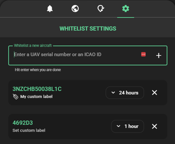
Our earlier update to the whitelisting feature brought new efficiencies, and we’re now expanding on that with custom labels. Easily tag whitelisted drones with names, use cases, or operator identifiers. This makes sorting and identifying friendly traffic simpler and faster during real-time operations.

Figure 2: Add a custom label to your whitelisted drones

6. New preference settings for a more personalised experience

You can now tailor your platform experience with individual settings for measurement units (metres or feet), time display (UTC or CEST), and interface theme (dark or light mode). These preferences are saved at the user level and automatically applied in future sessions—ensuring a consistent experience every time you log in.

These enhancements mark another step forward in our mission to empower users with the tools they need to ensure safe, efficient, and informed drone operations. Whether you’re securing a control zone, assessing drone traffic patterns, or coordinating complex airspace usage, these features are designed to support your operational goals.

Stay tuned—there’s more innovation on the horizon!

Log in to your Drone Radar and Drone Analytics applications today to see these new features in action.

The post 6 New Features That Put You in Full Control of Your Airspace first appeared on SkeyDrone.

☐ ☆ ✇ SkeyDrone

Best-in-Class Traffic Information Service: A Game Changer for BVLOS Drone Operations

By: Nele Coghe

A Key BVLOS Enabler

In the rapidly evolving world of drone operations, ensuring safety for drones flying Beyond Visual Line of Sight (BVLOS) is paramount. Traditionally, pilots rely on the ‘see and avoid’ principle to navigate safely in the air. However, with BVLOS operations, this principle is replaced by ‘detect and deconflict,’ allowing remote pilots to make informed decisions in real time.

A robust Traffic Information Service (TIS) is a crucial enabler for BVLOS drone operations. Without direct visual contact, pilots must rely on real-time traffic data to safely navigate the airspace and avoid conflicts. SkeyDrone’s TIS goes beyond standard industry solutions, ensuring complete airspace awareness.

Unmatched Coverage: Cooperative and Non-Cooperative Drone Traffic

Unlike conventional solutions that only display cooperative drone traffic, SkeyDrone’s TIS provides a complete picture by incorporating both cooperative and non-cooperative air traffic. Cooperative drones are visualized using either their direct remote ID or their telemetry data. Our nationwide drone detection network captures and displays non-cooperative drones, significantly reducing the risk of mid-air conflicts. This comprehensive approach enhances safety and enables seamless integration of drones into shared airspace.

Beyond Standard Aviation Data: A Holistic Approach

For crewed aviation, our TIS doesn’t just rely on the usual data sources such as Mode-S, ADS-B, and FLARM. We take it a step further by integrating with community-based platforms like SafeSky and ADS-B Exchange. This means that drone pilots gain access to the most extensive real-time traffic data available without the need for additional integrations. By combining multiple data sources, we ensure drone operators have a full, accurate, and continuously updated traffic picture.

Leading the Future of Drone Traffic Management

As drone operations continue to grow, the need for an advanced and reliable Traffic Information Service has never been greater. SkeyDrone’s TIS is setting new industry standards, ensuring that drone operators can conduct BVLOS flights with confidence, efficiency, and, most importantly, safety. By combining real-time data from multiple sources, including non-cooperative traffic detection, SkeyDrone is empowering the future of autonomous and integrated drone operations.

Want to learn more about our TIS? Download the brochure here.

The post Best-in-Class Traffic Information Service: A Game Changer for BVLOS Drone Operations first appeared on SkeyDrone.

☐ ☆ ✇ SkeyDrone

First Drone Flight with Active Deconfliction in Controlled Airspace around Brussels Airport

By: Nele Coghe

Vilvoorde, 20 March 2025 – For the first time, a drone flight took place in the controlled airspace around Brussels Airport, with active deconfliction between ATM (Air Traffic Management for traditional crewed aviation) and UTM (for uncrewed aviation). skeyes, in its role as Common Information Service Provider (CISP), and SkeyDrone, as a drone operator and U-space Service Provider (USSP), exchanged data intensively, allowing the airspace to remain active for traditional crewed aviation while simultaneously integrating a drone flight safely.

The drone took off from the twelfth floor of the Living Tomorrow Innovation Campus in Vilvoorde. The flight was the result of a collaboration between skeyes, SkeyDrone, Living Tomorrow and DroneLand.
This groundbreaking operation marked a significant step in the safe integration of crewed and uncrewed aviation within the Controlled Traffic Region (CTR) of an international airport.

A New Milestone for U-space and Safe Drone Integration

The drone was remotely controlled and crossed the Brussels Ring Road four times. The control signal for the uncrewed aircraft came from the control room of drone operator SkeyDrone, a subsidiary of skeyes and Brussels Airport, located in Steenokkerzeel, 13 kilometers in a straight line from Living Tomorrow. The flight was conducted in close coordination with skeyes, the Air Navigation Service Provider responsible for all flight movements over Belgian territory up to an altitude of 7,500 meters, whether crewed or uncrewed.

The Future of Drone Integration in Belgium

This historic flight highlights Belgium’s efforts to take a leading role in the European aviation sector. Through collaboration between public and private partners, the path is being paved for the safe and efficient integration of drones into our airspace, with applications in logistics, urban mobility, and emergency response.

Johan Decuyper, CEO of skeyes comments: “This flight proves that we are ready to take the next step with drones for beyond visual line of sight operations near complex airspaces around airports. The experiences gained here contribute to a workable ecosystem where economically relevant applications for unmanned aviation are possible, without compromising the safety and efficiency of traditional aviation.”

Living Tomorrow as an Innovative Launch Platform

The choice of the Living Tomorrow Innovation Campus as the take-off location underscores Belgium’s forward-thinking vision for aviation innovation. This iconic building serves as a test environment for new technologies, where drones play a key role in urban mobility and logistics applications.

Yin Oei, CEO of Living Tomorrow adds: “Our campus is the ideal place to demonstrate the future of aviation. We aim to make innovative technologies accessible to businesses and governments, with a focus on sustainability and efficiency.”

The Role of SkeyDrone and DroneLand

As a subsidiary of skeyes, SkeyDrone plays a crucial role in the implementation of U-space in Belgium. U-space is an innovative concept enabling the safe and efficient integration of drones into airspace. Thanks to U-space, drones will be able to operate in busy and complex airspaces, opening new possibilities for commercial and societal applications such as parcel delivery, inspections, and emergency response.

DroneLand, a leading provider of drone solutions in the Benelux, contributes expertise in drone hardware and software. Their extensive knowledge and services, including training and maintenance, support the continued professionalization of drone operations.

Click here to replay the flight in our Drone Analytics solution.

The post First Drone Flight with Active Deconfliction in Controlled Airspace around Brussels Airport first appeared on SkeyDrone.

☐ ☆ ✇ SkeyDrone

SkeyDrone and SafeSky Exchange Traffic Data to Enhance Safety in the Skies

By: Nele Coghe

Steenokkerzeel, 11 March 2025 – SkeyDrone is enhancing its Traffic Information Service (TIS) by integrating real-time traffic data from SafeSky while providing SafeSky with uncrewed aircraft data in return. Used by drone pilots operating beyond visual line of sight (BVLOS), SkeyDrone’s TIS offers a comprehensive situational awareness solution by displaying both crewed and uncrewed traffic.

SafeSky, a leading provider of anti-collision technology, offers an app used by over 85,000 pilots across Europe. This includes pilots of helicopters, gliders, paramotors, paragliders, trikes, and other aircraft, who share real-time in-flight traffic data either through the SafeSky mobile app or via one of the 30 integrated hardware and software solutions. By leveraging the GPS chip in their smartphones, SafeSky pilots transmit their position to others within the SafeSky network.

Many SafeSky pilots fly without a (ADS-B or other) transponder, making their aircraft invisible to traditional surveillance systems. By integrating SafeSky data, SkeyDrone’s TIS gains access to additional flight information, further enriching its traffic picture for lower flying aircraft. This ensures that drone operators are fully equipped to fly BVLOS.

In return, SafeSky is receiving cooperative and non-cooperative uncrewed traffic data from SkeyDrone for flights above 500 feet. This integration enables SafeSky pilots to receive drone activity alerts, enhancing safety for all airspace participants.

This collaboration marks an important step towards improving airspace awareness and safety as the skies become increasingly shared between crewed and uncrewed aircraft.

Tristan Fily, CEO of SafeSky, commented, “This collaboration with SkeyDrone is an important milestone in our mission to make the skies safer for all. By sharing our traffic data, we are providing pilots with a more comprehensive view of the airspace reducing the risk of conflicts between crewed and uncrewed aircraft.”

Hendrik-Jan Van Der Gucht, Managing Director of SkeyDrone, added, “We are excited to partner with SafeSky. This data exchange not only improves our Traffic Information Service but also supports the broader goal of safe and efficient airspace integration for both crewed and uncrewed aircraft.”

About SafeSky

SafeSky, a pioneering Belgian start-up founded by six passionate pilots, is a leading provider of real-time air traffic awareness solutions, dedicated to enhancing flight safety for all airspace users. Through its innovative anti-collision app, SafeSky enables pilots of various aircraft—including helicopters, gliders, paramotors, ultralights and general aviation—to share their position and receive real-time traffic alerts. By leveraging collaborative data-sharing, SafeSky contributes to a safer and more integrated airspace.

About SkeyDrone

SkeyDrone is a joint venture between the Belgian Air Navigation Service Provider skeyes and Brussels Airport Company. The company’s mission is to provide end-to-end solutions for business needs related to the use of uncrewed aircraft (drones). SkeyDrone offers solutions for lower airspace monitoring, management of and protection against drones for authorities and geo-zone managers, UTM/U-space & consultancy services for drone operators and business integration services for companies. Playing a pivotal role in the implementation of U-space in Belgium, SkeyDrone is on track to make history by becoming one of the first U-space service providers in Europe.


The post SkeyDrone and SafeSky Exchange Traffic Data to Enhance Safety in the Skies first appeared on SkeyDrone.

☐ ☆ ✇ SkeyDrone

Employee in the Spotlight: Chloé

By: Nele Coghe

On the occasion of International Women’s Day, we sat down with Chloé Hannouille, to discuss her journey into product management, what excites her most about the role, and how companies can foster greater diversity in tech.

From Digital Marketing to Product Management

Chloé joined SkeyDrone about one year ago as Senior Product Manager, but her career path wasn’t always set on product management. “I didn’t originally plan to work in this field,” she admits. With a background in applied communication, specializing in public relations and digital marketing, her initial ambitions leaned towards journalism. “At one point, I even considered becoming a wedding organiser,” she laughs. “Looking back, that would have been a terrible fit for me!”

Interestingly, another career path she considered—interior architectural design—shares some unexpected similarities with product management. “Both involve listening to needs, creating something engaging, and designing an experience that resonates with people.”

Her transition into product management was driven by a desire for new challenges. “The role of a digital product manager was still relatively new, and there was a lot to build from scratch. That made it exciting—defining processes, shaping the vision, and bringing structure to something evolving.”

The Thrill of Product Management

Ask Chloé what she loves most about her job, and she lights up. “The variety and the impact,” she says. “One day, I’m deep in discussions with the technical team, the next, I’m speaking with customers to understand their challenges. It’s a mix of strategy, problem-solving, and collaboration—no two days are the same.”

But what truly excites her is seeing a product evolve from an idea into something that genuinely helps people. “Shaping a product that’s both functional and visually appealing is so rewarding. The challenge is to balance business needs with a great user experience.”

Lessons from Mentors and Role Models

Throughout her career, Chloé has drawn inspiration from those around her. “I’ve been lucky to work with incredible people who have guided me. Some of my biggest lessons came from colleagues who challenged me to think differently or encouraged me when I doubted myself.”

Being the Only Woman on the Team

As the only female on her team, Chloé acknowledges the experience is unique. “To be honest, I don’t focus on gender. What matters most is personality fit—working with people who share the same mindset and values.”

That said, she admits there are moments when she wishes she had another woman on the team. “Sometimes, I miss that shared perspective. But overall, I’ve learned to navigate the environment by focusing on the work, building strong relationships, and making sure my voice is heard.”

Encouraging More Women in Tech and Product Roles

So, what can companies do to attract and retain more women in tech? “There’s no single fix,” Chloé says. “But it starts with breaking down the barriers around these roles. Tech isn’t rocket science, yet it can seem intimidating. That perception might discourage some women from pursuing careers in the field.”

She believes fostering inclusivity is key. “It’s about representation at all levels, providing clear career growth opportunities, and offering flexibility for different life stages. Ultimately, tech and product roles should be accessible to everyone—not just those with a technical background, but also those with diverse skills and perspectives.”

Chloé’s journey is a testament to the power of adaptability, curiosity, and embracing new challenges. As we celebrate International Women’s Day, her story is a reminder that career paths don’t have to be linear—and that diversity in tech starts with creating an environment where everyone feels they belong.

Interested in more employee stories? Read the interview with Benoît here

The post Employee in the Spotlight: Chloé first appeared on SkeyDrone.

☐ ☆ ✇ SkeyDrone

From Riga to Today: A Decade of Drone Innovation and Regulation in Europe

By: Nele Coghe

Exactly 10 years ago, on 6 March 2015, the European aviation community gathered in Riga to exchange views on how, and under which conditions, drones could help create promising new opportunities in Europe, offering sustainable jobs and new prospects for growth both for the drone manufacturing industry and for future users of drones in all sectors of society.

The aviation community then established five principles to guide the regulatory framework in Europe. Let’s see what the status of those is today.

1. Drones need to be treated as new types of aircraft with proportionate rules based on the risk of each operation

EU Regulation 2019/947, which is applicable since 31 December 2020 in all EU Member States, caters for most types of civil drone operations and their associated risk levels. It defines three categories of civil drone operations: the ‘open’, the ‘specific’ and the ‘certified’ category. The ‘open’ category includes flights with the lowest risk to people on the ground, either executed with small drones close to people, or heavy drones but far away from people. The ‘specific’ category covers riskier drone operations, where the drone operator ensures safety by drafting a detailed risk analysis and obtaining an operational declaration or authorisation from the national competent authority before starting the operation. In the ‘certified’ category, the safety risk is considered very high, e.g. transporting peoply by taxi drones. In this category, rules are more similar to crewed aviation where safety is ensured by a.o. the airworthiness certification of the drone operator and its drone, and additionally the licensing of the remote pilot(s) is always required to ensure safety.

On top of these generic flight category rules, a Member State can furthermore designate ‘geozones’ where additional national rules apply to mitigate location-specific risks, e.g. no fly zones close to airports or critical infrastructure sites.

The risk-based regulation is in place, so this principle can be considered addressed. However, the ‘certified’ category, which carries the highest risk, still requires further work regarding passenger drone certification.

2. EU rules for the safe provision of drone services need to be developed

In April 2021, the European Commission adopted the U-space package, which became applicable as of 26 January 2023. The U-space package consists of three regulations that together create the conditions necessary for both drones and crewed aircraft to operate safely while sharing the same U-space airspace.

These regulations introduced new services for drone operators, allowing them to carry out more complex and longer distance operations, particularly in congested, low-level airspace (below 120m), and beyond visual line of sight (BVLOS). U-space creates and harmonises the conditions needed for crewed and uncrewed aircraft to operate safely and to prevent collisions between drones and other aircraft.

Although sharing the same airspace, state aircraft drone operations are by default exempted from the U-space regulation. As such, it’s still up to each Member State to decide whether there is an opt-in to U-space for this type of operations. With plenty of police forces and fire brigades increasingly relying on the use of drones, ignoring U-space becomes less of an option.

The U-space framework has been established, and the initial implementations of U-space have already started in some EU Member States. However, there remains a gap in knowledge, resources, and experience necessary to effectively scale up U-space deployment.
On top of that, the regulation leaves quite some room for Member States to implement their own flavor, jeopardizing a harmonised implementation across Europe.

3. Technologies and standards need to be developed for the full integration of drones in the European airspace

To enable safe and efficient drone operations, the U-space framework introduced digital services that all drone operators must use through their chosen U-space Service Provider (USSP):

  • Geo-awareness service: Ensuring drone operators are aware of geozones where restricitons apply.
  • UAS Flight Authorisation service: Ensuring all drone flight plans are properly deconflicted in both space and time, so no two drone flights can occur at the same time at the same location.
  • Network Identification service: Allowing USSPs to know in real-time where their customers’ drones are flying, and sharing that information with relevant authorities.
  • Traffic Information service: Providing a full air picture to drone operators of where both drones and other crewed aircraft are flying.

Needless to say that these services heavily rely on the exchange of data, both among USSPs as well as to and from authorities and other aviation stakeholders such as air traffic service providers.

Several European companies, including SkeyDrone, are developing these services and hence aim to become certified U-space service providers. The first U-space airspace designations are starting to take shape across EU member states, including in Belgium through the BURDI project. During that implementation effort, the lack of a required full set of useable interoperability standards became an issue which had to be solved.

4. Public acceptance is key to the growth of drone services

According to several studies and surveys, public acceptance of drones in the EU remains mixed, depending on their use case, perceived benefits, and concerns about safety, privacy, and noise pollution. Public support is strongest for drones used in emergency response, medical deliveries, and infrastructure inspections.

We believe that public acceptance will improve as drones become more visible in positive use cases like healthcare logistics and emergency response. Transparent communication, noise reduction efforts, and strong safety measures will be key to easing concerns about drones flying over populated areas. Making sure a properly developed law enforcement framework, removing the clueless and careless drone operators from the equation, can additionally support the social acceptance.

5. The operator of a drone is responsible for its use

Several cases are known of drone operators facing fines for violation drone regulations in the EU. In Belgium (July 2023), a drone pilot was fined €8,000 for not respecting the air traffic regulations during the music festival Tomorrowland. In Sweden (July 2024), a drone pilot was fined 32,000 SEK for operating a drone in a temporary no-fly zone, under the influence of alcohol during a classic car event in Rättvik, Dalarna. In Italy (April 2016), a French tourist was arrested and faced a fine of up to €113,000 after he flew his drone over the Colosseum in Rome.

Although drone operators are held responsible for their actions, there is still a lack of knowledge about the legislation among drone pilots, such as the requirement to request flight authorisation in specific geozones. SkeyDrone’s drone detection system has indicated that authorised flights constitute only a small portion of the total drone activity.

Conclusion

While these five principles have successfully guided the regulatory framework in Europe, practical implementation and industry adaptation remain ongoing challenges. Nevertheless, there’s been a significant increase in drone traffic in Europe over the past ten years and no major incidents or accidents have happened. We’re all looking forward to a steady increase the next ten years.

Click here to read all about SkeyDrone’s 2025 U-space vision.

The post From Riga to Today: A Decade of Drone Innovation and Regulation in Europe first appeared on SkeyDrone.

☐ ☆ ✇ SkeyDrone

SkeyDrone’s Drone Detection Solution to Secure Aalst Carnaval

By: Nele Coghe

Steenokkerzeel/Aalst, 27 February 2025 –SkeyDrone is proud to announce the implementation of its advanced drone detection solution to ensure the safety and security of the upcoming Aalst Carnaval. This innovative technology will provide comprehensive airspace monitoring, enhancing the protection of one of Belgium’s most celebrated events.

Aalst Carnaval attracts approximately 100,000 visitors each year. The event, which dates back to the 15th century, is celebrated over three days preceding Ash Wednesday. It features colourful parades, satirical floats, and the unique tradition of ‘Voil Jeannetten’ where men dress in old women’s clothes. Given its scale and significance, ensuring the safety of spectators and participants is a top priority for local authorities.

As drones become increasingly accessible, the potential risks associated with their misuse have grown. To address these concerns, the Local Police of Aalst has partnered with SkeyDrone, a leading provider of drone services and software. The deployment of SkeyDrone’s technology will provide real-time insights into drone activity, allowing authorities to respond swiftly to any potential threats.

To further enhance airspace security, a geozone will be active between March 2 and March 5 above the city of Aalst. Each drone flight within this zone must be requested at least two weeks in advance.

Jürgen Dhaene, Chief of the Local Police of Aalst, commented: “Ensuring public safety during Aalst Carnaval is our highest priority. With the rise of drone use, we must stay ahead of potential risks. SkeyDrone’s advanced detection technology gives us real-time visibility and the necessary tools to act decisively, ensuring a secure and enjoyable experience for all.”

Hendrik-Jan Van Der Gucht, Managing Director of SkeyDrone, added: “We are proud to support the Local Police of Aalst in safeguarding such a significant cultural event. Aalst Carnaval attracts thousands of visitors each year, and our technology will help ensure the airspace remains secure, allowing everyone to enjoy the festivities with peace of mind.”

About SkeyDrone

SkeyDrone is a joint venture between the Belgian Air Navigation Service Provider skeyes and Brussels Airport Company. The company’s mission is to provide end-to-end solutions for business needs related to the use of uncrewed aircraft (drones). SkeyDrone offers solutions for lower airspace monitoring, management of and protection against drones for authorities and geo-zone managers, UTM/U-space & consultancy services for drone operators and business integration services for companies. Playing a pivotal role in the implementation of U-space in Belgium, SkeyDrone is on track to make history by becoming one of the first U-space service providers in Europe.

The post SkeyDrone’s Drone Detection Solution to Secure Aalst Carnaval first appeared on SkeyDrone.

☐ ☆ ✇ SkeyDrone

Streamline drone monitoring with our updated whitelisting feature

By: Nele Coghe

Managing drone activity efficiently requires a balance between security and operational clarity. Unnecessary alerts can create noise, making it harder to focus on potential threats. That’s why we’re excited to introduce the updated whitelisting feature in Drone Radar & Monitor, designed to help geozone managers, security teams, law enforcement and drone operators streamline drone monitoring while maintaining compliance with airspace regulations.

What is whitelisting?

The whitelisting feature allows users to mute known drones and aircraft, ensuring they receive only the most relevant alerts. This means you can stay focused on unauthorised activity while maintaining complete oversight of the airspace.

Key features & benefits

  • One-click whitelisting
    Instantly approve a drone or aircraft directly from the aircraft details screen.

  • Whitelisting in settings
    Manage known drones (by Serial Number) and crewed aircraft (by ICAO ID) upfront to reduce repetitive alerts.

  • Flexible duration options
    Choose how long a drone remains whitelisted: 30 minutes, 1 day, or indefinitely until you decide to remove it.

  • Preserves the official authorisation process
    Whitelisting does not replace required flight authorisations; it simply prevents unnecessary alerts for pre-approved drones.

  • Enhanced situational awareness
    Stay focused on unauthorised drone activity, enabling faster responses and clearer airspace oversight.

The updated whitelisting feature is now available in Drone Radar & Monitor—try it today and experience smarter, more efficient drone detection!

The post Streamline drone monitoring with our updated whitelisting feature first appeared on SkeyDrone.

☐ ☆ ✇ SkeyDrone

Nationwide strike: a golden opportunity to fly my drone at airports? Not quite.

By: Nele Coghe

Today, as part of a nationwide strike led by unions, no flights will take off or land in Belgium between 06:45 and 22:15. With all flights grounded at major airports, drone operators might wonder if this could be the perfect chance to fly a drone in airport areas—whether for fun or to inspect assets. After all, if no aircraft are flying, it should be safe to operate a drone, right?

That assumption might seem logical at first sight, but let’s take a closer look at the regulations.

Legislation and geozones

Drone flight restrictions around major Belgian airports are determined by predefined geozones. Each geozone consists of multiple subzones, called Very Low Level airspace (VLL), categorized based on their proximity to the airport and the associated risk level for crewed aviation:

  • VLL0: Over and close to the actual runways
  • VLL1: Above and near the airport perimeter
  • VLL2: Further away from the airport but still within controlled airspace
Geozones around the major Belgian airports

A common misconception is that if flights are grounded, these geozones become irrelevant. However, that’s not the case. The activation of these zones is not based on whether air traffic controllers are present or whether flights are operating.

To determine the exact activation conditions for these geozones, we must refer to the Ministerial Decree governing geozones. The activation differs per specific subzone:

  • The entire geozone of Kortrijk-Wevelgem International Airport and the VLL0 subzones of all other airports are permanently active, regardless of whether the airport is operational or air traffic controllers are working.
  • The activation of all VLL1 and VLL2 subzones is directly linked to the published lower airspace associated with the airport, i.e. the Control Zone (CTR). According to the Belgian Aeronautical Information Publication (AIP), while activation conditions vary slightly by airport, the key takeaway is clear: geozones are never deactivated based on air traffic control service levels, and most are permanently active.

Conclusion

Even in exceptional cases like an airport shutdown, drone operators must adhere to the same regulations. Airport geozones remain active, and all flight restrictions continue to apply.

This means drone pilots must still request flight authorization via the Drones & Aerial Activities platform.

Stay informed, fly responsibly, and always check the regulations before taking off!

The post Nationwide strike: a golden opportunity to fly my drone at airports? Not quite. first appeared on SkeyDrone.

☐ ☆ ✇ SkeyDrone

Our 5-Year Journey: Highlights and Milestones

By: Nele Coghe

This February marks a significant milestone for SkeyDrone as we celebrate our 5-year anniversary. What began as a vision to revolutionize the skies has grown into a thriving company at the forefront of drone technology and airspace management. Over the past five years, we’ve worked tirelessly to enable safe, efficient, and innovative drone operations, shaping the future of aviation.
To honor this special occasion, we didn’t only celebrate with a customized cake but we also reflected on our journey. This has resulted in a timeline of the major milestones that have defined our growth and success.

10 February 2020

Founding of SkeyDrone

The journey began when skeyes launched SkeyDrone as a subsidiary to consolidate its drone-related activities. Our founding team of four employees, with deep aviation expertise gained from skeyes and Eurocontrol, laid the groundwork for what would become a thriving company.

22 December 2020

UTM Platform Launch

The launch of our Uncrewed Traffic Management (UTM) platform, the Drone Service Application, marked a first significant milestone. This platform empowered drone operators to request flight authorisation in controlled Belgian airspace, streamlining operations and enhancing safety. In a later stage, the platform was extended to the military geozones.

1 April 2021

First Drone Detection Test

We successfully tested the first version of our drone detection solution at Brussels Airport during the pandemic-induced closure. Leveraging both radar and RF-based detection technologies, this test marked the start of our commitment to protecting the airspace from unauthorised drones.

19 October 2021

Partnership with Brussels Airport

Brussels Airport Company acquired a 50% stake in SkeyDrone, aligning its vision with our ambitions. By bringing its extensive aviation expertise and resources to the table, Brussels Airport has played a crucial role in supporting our growth.

5 May 2023

Today we witnessed D-Hive's first regular BVLOS flight in the POAB

BVLOS Operations Begin

Our BVLOS enablement framework facilitated the launch of D-Hive, a network of six drone-in-a-box systems at the Port of Antwerp. These systems conducted up to 18 daily flights, coordinating safe and sustainable operations in one of Europe’s busiest ports.

21 July 2023

Drone Detection at Tomorrowland

We deployed our drone detection solution at a major festival for the first time, safeguarding the skies above Tomorrowland. The police successfully intercepted 12 unauthorised drones, ensuring the safety of 65,000 attendees.

2 January 2024

Permanent Drone Detection Network

At the start of 2024, we began rolling out our permanent drone detection network across Belgium, covering major critical zones and infrastructure. In 2024, our network detected an average of 2,600 drone flights per month, providing valuable insights and enhancing airspace security.

20 March 2024

Recognition at ATM Awards

Our drone detection solution gained international recognition at Airspace World in Geneva, where we earned the runner-up award in the “Integration of Drones/AAM” category at the prestigious ATM Awards.

31 December 2024

Successful AI Pilot Project at Brussels Airport

In a groundbreaking AI project, SkeyDrone’s drone pilots captured over 2,000 high-resolution images at various locations around Brussels Airport. These images were used to train AI models, leading to enhanced airport safety and improved operational efficiency in areas such as crop inspections, fire intervention route evaluation, and obstacle detection.

Looking Ahead

As we celebrate our achievements over the past five years, we remain committed to driving innovation in drone technology and airspace management. This journey would not have been possible without the dedication of our talented team, the trust of our partners, and the support of our stakeholders.

Here’s to the next chapter of SkeyDrone, where the skies are no longer the limit but just the beginning!

Want to learn more about SkeyDrone’s beginnings? Read the interview with our founding team here.


The post Our 5-Year Journey: Highlights and Milestones first appeared on SkeyDrone.

❌